For me, Washington D.C. is all about the buildings. In my world of keywording, buildings also include monuments, bridges, and memorials. Steeped in history, full of stories, iconic, architecture, and design all catch my eye. I couldn’t get enough. Here they are, in no particular order.
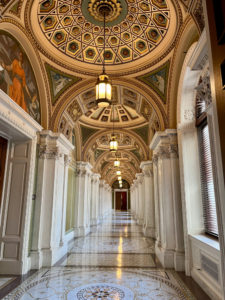
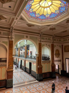
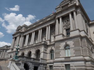 The Library of Congress was NOT what I pictured it to be. From what we saw it was much more a museum than a library. Apparently, it is the official research library that serves the United States Congress and is the de facto national library of the United States. It is the oldest federal cultural institution in the country and is one of the largest libraries in the world. Its collections are universal, not limited by subject, format, or national boundary, and include research materials from all parts of the world and in more than 470 languages. Who knew?
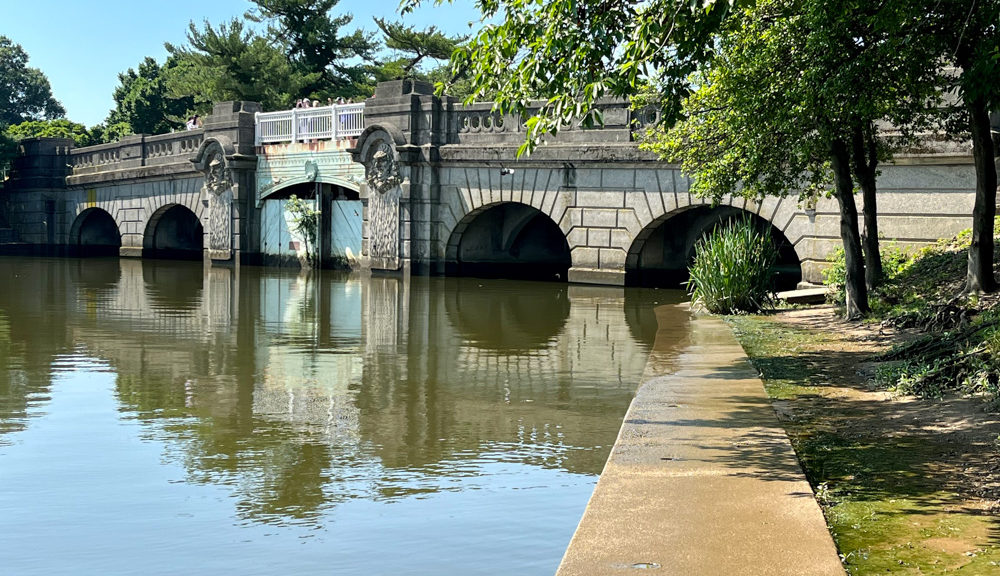
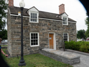 We stumbled across this building on our way to a March for our Lives rally. Excluding the White House, the Lockkeeper’s House is the oldest building on the National Mall, built in 1837.
The building dates to a period when this area was a wharf and was the location of a section of the Washington City Canal, which connected the Potomac and Anacostia rivers. Here, an eastward extension of the Chesapeake and Ohio Canal met the Potomac River and the Washington City Canal at a canal lock.
The 350-square-foot house served the canal lock keeper, who collected tolls, recorded commerce, maintained the canal, and managed traffic.
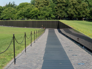 The Vietnam Memorial was powerful. The names on the Wall, originally numbering 57,939 when it was dedicated in 1982, are listed in the chronological order of the casualty dates. It’s interesting how short the wall is from the early days of the war and startling how tall it gets in the middle. Additional names have since been added and as of May 2018, there were 58,320 names. The number of names on the wall is different from the official number of U.S. Vietnam War deaths, which is 58,220 as of May 2018.
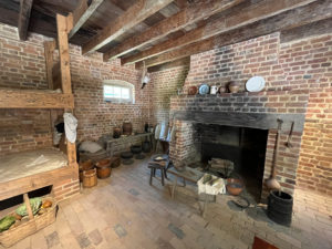
Mount Vernon was a beautiful way to spend an afternoon. The main building was under renovation so we wandered the grounds. It became less beautiful as we entered the slave quarters and realized how many people were owned to make these grounds a working farm back in the day. The above image is a room of the restored slave quarters.
The plantation is on the banks of the Potomac River in Fairfax County, Virginia, just south of Washington, D.C.
The Washington family acquired land in the area in 1674. Around 1734, the family embarked on an expansion of its estate that continued under George Washington, who began leasing the estate in 1754 before becoming its sole owner in 1761.
In 1858, the house’s historical importance was recognized and it was saved from ruin by the Mount Vernon Ladies Association; this philanthropic organization acquired it together with part of the Washington property estate. Escaping the damage suffered by many plantation houses during the American Civil War, Mount Vernon was restored.
Mount Vernon was designated a National Historic Landmark in 1960 and is listed on the National Register of Historic Places. It is still owned and maintained in trust by the Mount Vernon Ladies Association and is open every day of the year. Allowing the public to see the estate is not an innovation, but part of an over 200-year-old tradition started by George Washington himself. In 1794 he wrote: “I have no objection to any sober or orderly person’s gratifying their curiosity in viewing the buildings, Gardens, &ca. about Mount Vernon.”
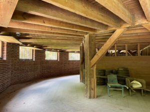
This is an image of the lower floor of a round barn found on the property. It was invented to have hay laid out on the above floor, have horses walk on it, and ground it up to have it fall through to the bottom floor and be swept up and used. It was cutting-edge technology back then.
 The Capital is located on Capitol Hill at the eastern end of the National Mall. Though no longer at the geographic center of the federal district, the Capitol forms the origin point for the district’s street-numbering system and the district’s four quadrants.
Central sections of the present building were completed in 1800. These were partly destroyed in the 1814 burning of Washington, then were fully restored within five years. The building was later enlarged by extending the wings for the chambers for the bicameral legislature, the House of Representatives in the south wing, and the Senate in the north wing. The massive dome was completed around 1866 just after the American Civil War.
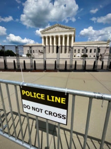 The Supreme Court Building also referred to as “The Marble Palace,” serves as the official workplace of the Chief Justice of the United States and the eight Associate Justices of the Supreme Court. It is located in the block immediately east of the United States Capitol and north of the Library of Congress. On May 4, 1987, the Supreme Court Building was designated a National Historic Landmark.
The proposal for a separate building for the Supreme Court was suggested in 1912 by President William Howard Taft, who became Chief Justice in 1921. In 1929, Taft successfully argued for the creation of the new building but did not live to see it built. Physical construction began in 1932 and was officially completed in 1935 under the guidance of Chief Justice Charles Evans Hughes, Taft’s successor.
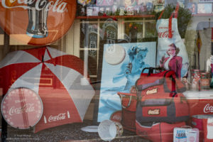
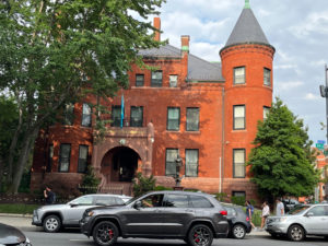
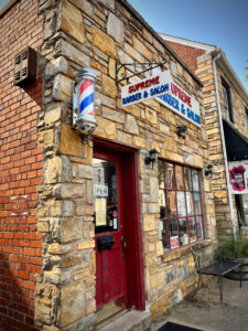
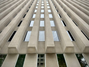 I don’t remember what this building is but we got out of the car, I looked up and saw this…so I SHOT it.
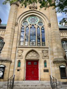
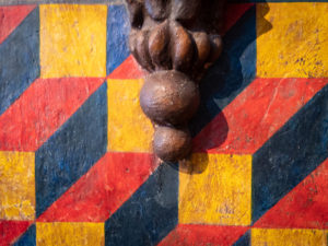
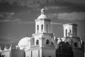
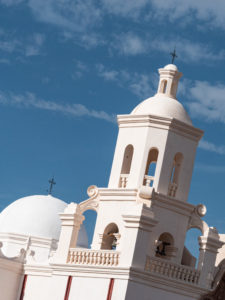
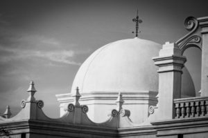
Beautiful architecture was everywhere, be it churches, office buildings, or homes, it was everywhere.
 Walking from one place to another, outside of the National Mall, we would come across random buildings like the Embassy of Kazakstan.
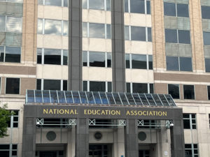 The National Education Association.
 The National Geographic Society.
 An iPhone picture of the White House. Some days you could get right up to the gate and some days not. Today was a good day.
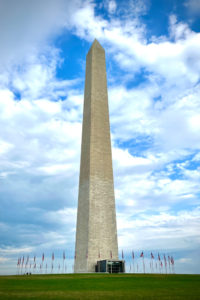 The Washington Monument’s construction began in 1848 and was halted for a period of 23 years, from 1854 to 1877 due to a lack of funds, a struggle for control over the Washington National Monument Society, and the American Civil War. It was built to commemorate George Washington, once commander-in-chief of the Continental Army (1775–1784) in the American Revolutionary War and the first President of the United States (1789–1797). Located almost due east of the Reflecting Pool and the Lincoln Memorial, the monument, made of marble, granite, and bluestone gneiss, is both the world’s tallest predominantly stone structure and the world’s tallest obelisk at 555 feet 5+1⁄8 inches (169.294 m) tall, according to the National Park Service (measured 1884). It is the tallest monumental column in the world if all are measured above their pedestrian entrances. The cornerstone was laid on July 4, 1848; the first stone was laid atop the unfinished stump on August 7, 1880; the capstone was set on December 6, 1884; the completed monument was dedicated on February 21, 1885; and officially opened October 9, 1888.
We never did secure tickets to go up in it. Next time.
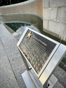 The World War II Memorial was stunning. But this plaque was possibly the most important part of the memorial. It is the Freedom Wall. It explains the price of freedom in very real terms. The wall holds 4,048 gold stars you can see behind the sign to the left. Each star represents one hundred American service personnel who died or remain missing in the war. The 405,399 Americans dead and missing from World War II are second only to the loss of more than 620,000 Americans during our Civil War. And THAT only includes our country. And only service members. Let that sink in for a minute.
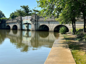
This is a super cute little bridge along the waterway of the Jefferson Memorial whose pillars you can see below.
I found this quote on the Southeast wall to be very pertinent to today’s politics: “I am not an advocate for frequent changes in laws and constitutions, but laws and institutions must go hand in hand with the progress of the human mind. As that becomes more developed, more enlightened, as new discoveries are made, new truths discovered and manners and opinions change, with the change of circumstances, institutions must advance also to keep pace with the times. We might as well require a man to wear still the coat which fitted him when a boy as civilized society to remain ever under the regimen of their barbarous ancestors.” I have more to say but I’ll stop there. 😉
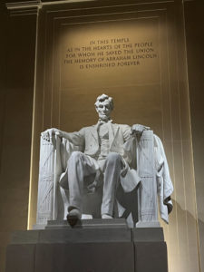
The Lincoln Memorial was dedicated in May 1922. It has always been a major tourist attraction and since the 1930s has sometimes been a symbolic center focused on race relations.
The memorial has been the site of many famous speeches, including Martin Luther King Jr.’s “I Have a Dream” speech delivered on August 28, 1963, during the rally at the end of the March on Washington for Jobs and Freedom.
The memorial is open to the public 24 hours a day, and more than 7 million people visit it annually.
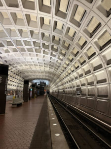 Even the Metro station is kinda cool inside.
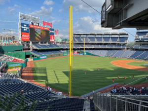 We went to a Washington Nationals Major League Baseball game with our friends. I even ate a hot dog.
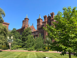 The Smithsonian Institution is legendary. I learned this at an exhibit: “The Smithsonian Institution started with a gift from an 18th-century English scientist named James Smithson who left his fortune to the United States, a country he had never seen. This exhibition looks at the history of the Smithsonian, focusing on its research, museums, and public programs in art, culture, history, and science and the role of the American public in the Smithsonian museums and research.
The Smithsonian is a partnership between its specialist staff and the American people. ”
Walking around old Alexandria we ran into some old buildings.
 I’m not sure what this building is but we emerged from the underground Metro to this. Stunning.
 This is the National Portrait Gallery which is full of, you guessed it, portraits! Among other art pieces.
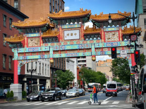 We didn’t go into Chinatown but found one of the entrances to it near the portrait gallery. Again, next time.
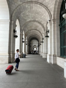 Here’s Ellen at Union Station, on our way to find the Amtrak train that will take us to New York City.
I hope you enjoyed the small sampling of the buildings we encountered on the D.C. portion of our June adventure.
Until next week, Happy Shooting!!
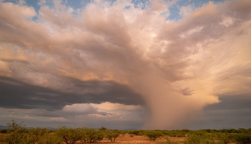
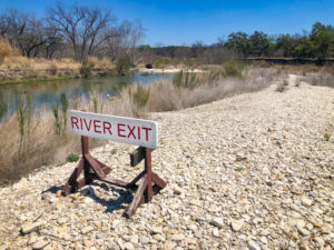 This denotes the location where day floaters can exit the South Llano River near our campground. This image will also show up under Nature. Nature is a HUGE category that I will discuss in September.
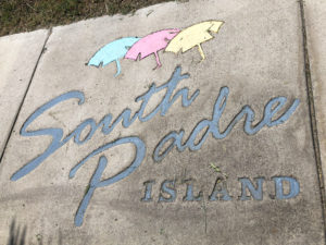 This would show up around town in South Padre Island.
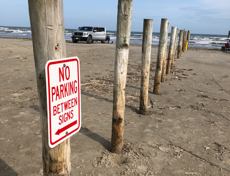
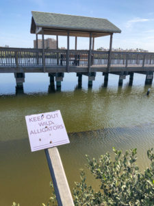 Also on South Padre Island, at the end of the island near the sand dunes was this sign. Ya just don’t see this in Flagstaff. This is another example of the second tag of Nature.
 I have more T-shirts than I could ever need so when I see a clever saying on one I SHOOT it!
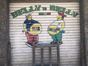 This shop door was also in Progresso and was also tagged under Art.
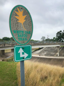 In Houston, I learned about bayous. There are miles and miles of mostly cement trails along the bayous of Houston which apparently are NOT rivers and not quite swamps. By definition, its a body of water typically found in a flat, low-lying area, and may refer to an extremely slow-moving stream or river (often with a poorly defined shoreline), a marshy lake or wetland, or a creek whose current reverses daily due to tides, and which contains brackish water highly conducive to fish life and plankton.
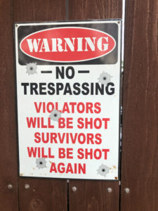 This sign would be more humorous if it wasn’t posted in Texas and in a country ripe with gun violence.
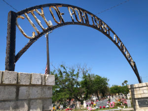 We love cemeteries. This is the sign above the one in Port Isabel.
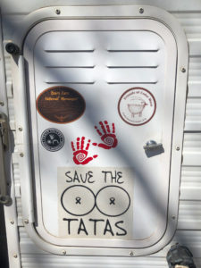
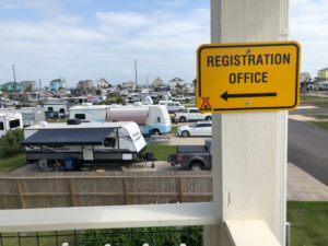 This is in the KOA Holiday Campground in Galveston Definitely not our jam.
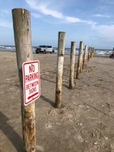 This beach was within walking distance of our KOA Galveston campground, which made it worth it. The beaches in Texas are low, flat and hard packed, perfect for driving and camping on.
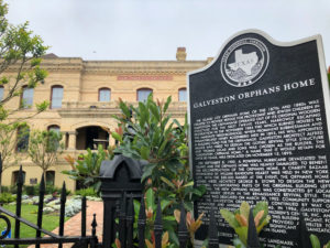 This is another image that is also tagged under Buildings. You probably can’t read it but the story of the Galveston Orphans Home was pretty interesting.
 That’s one old newspaper!
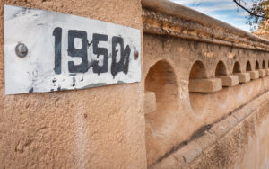
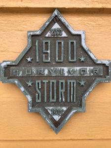 These plaques were posted on many buildings we came across in Galveston. The 1900
 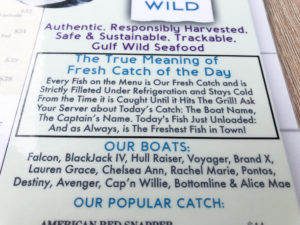 This is info I shot off the menu at Katie’s Seafood Restaurant in Galveston.
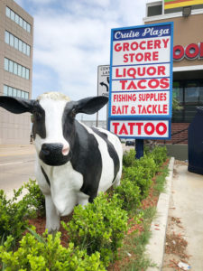 Talk about random. Grocery Store was not quite accurate. It was more of a convenience/sporting goods store.
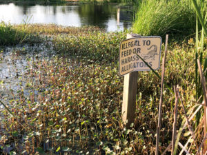 More alligator signs. This one was in the pond near Lake Ponchatrain at our camp in Louisiana. Yet another reason to sleep in a camper!
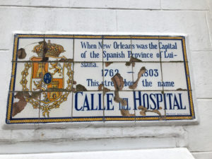 These tiled signs were all over New Orleans and I found them interesting.
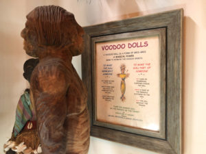 Lots of new information in the Voodoo Museum.
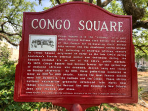 Another fascinating sign with historical information that we came across on our Voodoo Museum Tour. In colonial times, Congo Square was an open-air market where blacks—both enslaved and free—met on “free Sundays” to take part in sacred African rituals, talk, trade, and perform traditional songs and dance, helping lay the foundations for what would later become jazz.
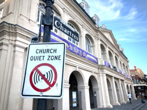 I found this sign to be a bit ironic as this church faces the square where a lot of activity happens during festivals.
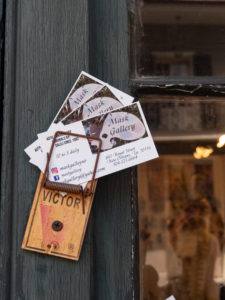 I thought this was a great way to offer business cards on the outside of your door.
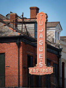


 Such an interesting combination of sign and statue. Like…are you welcoming me to…the end? Yikes!

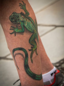
 Here are some plants and a pet that requires little attention.


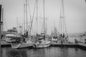
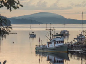
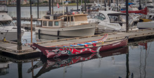 I could shoot boats all day long.
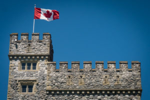
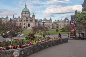 The Parliament Building was amazing.
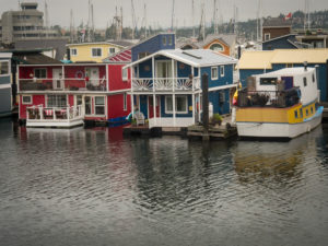


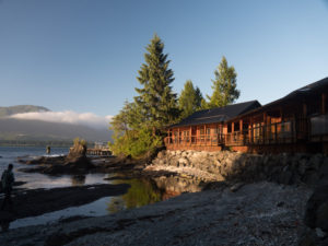 Yes, we stayed n these cabins. Check out the low tide.
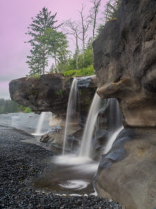

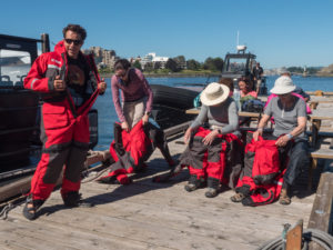 We each had to wear these survival suits. They were really hot but would save our lives should we end up in the ocean.
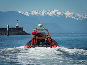
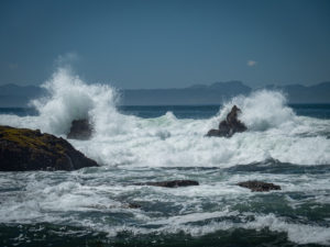
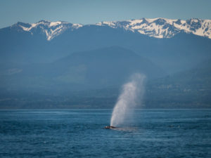
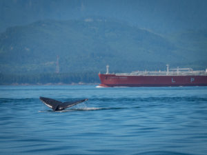 Ocean-going tankers and whale collisions is a real problem.
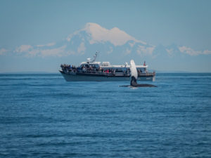 Another tour boat.
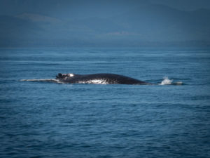


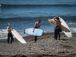
 To the right, you can see some blue rafts. These private boaters packed the night before and launched later that morning.

 Here we are having breakfast with Gary. He ran out to his car, grabbed some books, signed them, and sold them. He’s a great storyteller and was fun to hang out with.


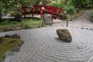
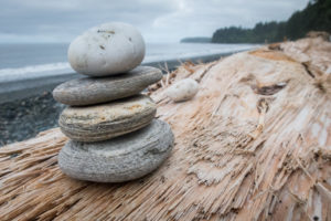
 I like pebbles.
 Unlike the Oregon Sampler, we photo guides did not have to drive. That allowed us more time to get to know our clients. And what an amazing group.
 It doesn’t matter how many times I go to Sedona, a quick 30-minute drive from my home, I am amazed at its beauty. This was our initial afternoon/sunset shoot.
 The next morning we hit Airport Mesa for sunrise and were treated with some hot air balloons in the distance.
 Before heading to Grand Canyon we dropped into Slide Rock State Park for some water action.
 The grand landscapes easily draw people’s attention but don’t forget to look at the details.
 Putting people in images helps show perspective and scale.
 Thank goodness for Desert View Tower! Nothing like a good man-made object on the edge of a natural wonder to help capture what you’re seeing and feeling.
 One can pretty much count on an elk encounter at the South Rim. They don’t ever seem too bothered by us humans.


 Black and white can be a good choice if you can’t quite get the colors right.
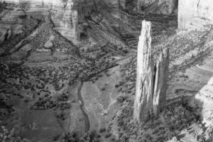
 On the way to Monument Valley, you have to drive through Kayenta. Just outside of Kayenta is Agathla Peak which rises over 1500 feet above the surrounding terrain. The mountain is considered sacred by the Navajo.

 Our afternoon/sunset shoot at the famous mittens.


 Shooting from one of the rim viewpoints.
 People still live at the bottom of the canyons. Can you find the house?


 This image was super contrasty as I shot it mid-day and din’t use my tripod or diffuser. To help with that issue I turned it into a low contrast black and white image.
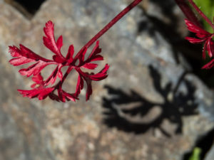
 I believe it was this workshop where I first began really noticing and being fascinated with shadows.
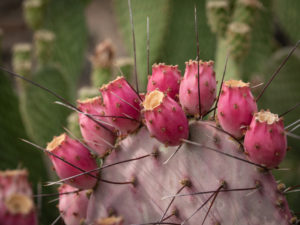
 I did break out my macro lens and capture these little red guys crawling all over a cactus flower.
 Nature’s patterns are everywhere! Shooting macro without a tripod can be difficult as the depth of focus is sometimes as thin as a credit card. Few people can hold steady enough to keep the subject in focus at that level. What I began to realize but couldn’t articulate for several more years is that I’m more of a close-up photographer as opposed to true macro.
 This image shows the depth of focus situation. The stamen around the glob in the center are in focus while the glob in the middle is not.